

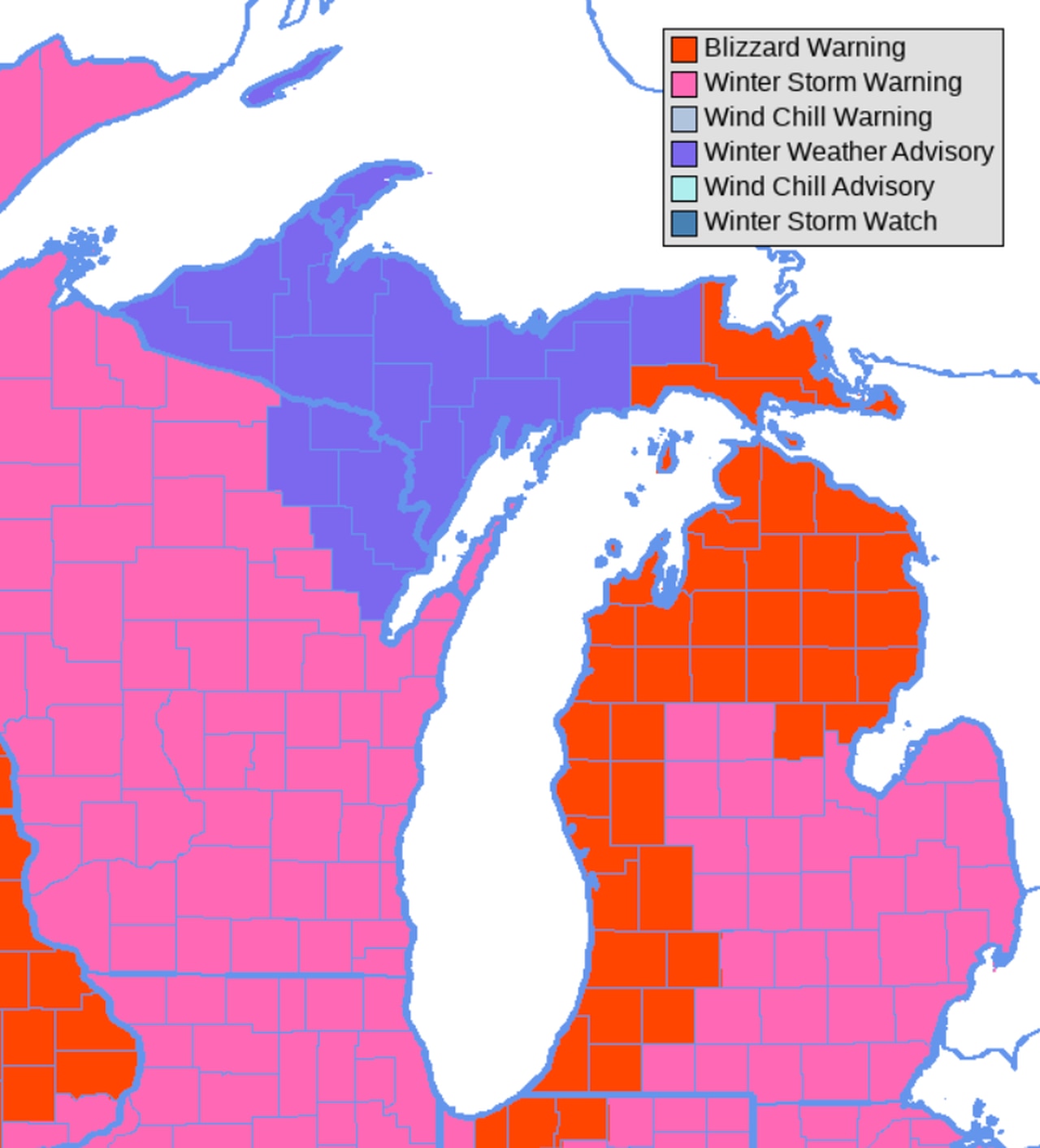
Blizzard Warnings expand across Lower Michigan, Southeast Lower goes to Winter Storm Warnings

Another National Weather Service office added many counties into the blizzard warning area of Lower Michigan.
Earlier today the NWS- Grand Rapids was the first NWS office in Michigan to issue blizzard warnings for the coming storm. Now the NWS at Gaylord has also added blizzard warnings for about the northern third of Lower Michigan and two counties in the eastern Upper Peninsula.
The blizzard warnings go into effect at 7 pm tomorrow, Thursday, December 22, 2022, and last until 7 pm Christmas Eve. The NWS at Gaylord separated the blizzard warning into two areas. The snow belt area of northwest Lower Michigan can expect at least one foot of snow and up to as much as two feet of snow. This would be an area from the entire Traverse City area north through Charlevoix, Petoskey, Gaylord and Grayling. The northeast part of Lower Michigan will have snow amounts up to one foot but still have dangerous blowing and drifting.
Remember- the official definition of a blizzard is for wind gusts over 35 mph for several hours, and those wind gusts reduce visibility to one-quarter mile or less due to blowing snow.
The strongest wind will occur Friday afternoon, Friday night and Saturday morning. Peak wind gusts over 45 mph will be widespread with isolated spots having gusts up to 55 mph.
One foot of snow with 45 mph to 55 mph gusts will make this more than just our normal few-times-a-year snowstorm. The National Weather Service says this should be the most dangerous snowstorm since the Ground Hog Day Blizzard of 2011.
They also have mentioned today that this snowstorm will not rival the strength of the Blizzard of ’78 or the Blizzard of ’67. I agree.
Winter storm warnings have been issued for the rest of Lower Michigan not in the blizzard warning. The severity of the winter storm warning is expected to be read as you move southeast into far southeastern Lower Michigan. The Saginaw Valley region should expect 5 to 9 inches of snow and gusts up to 55 mph. There is a possibility the Saginaw Valley will eventually need a blizzard warning by Friday afternoon and Friday night. The Flint area and Oakland County should expect 4 to 8 inches of snow and gusts up to 50 mph. This will still cause a lot of blowing and drifting. Finally the far southeast corner, including Detroit and Ann Arbor can look for only 2 to 4 inches of snow and wind gusts to 45 mph.
The snow starts Thursday night and becomes heavy at times by midday Friday. The wind will increase Friday morning to produce blizzard conditions by midday Friday. Snow will become more sporadic Saturday, but winds will still gust to 45 mph. Blizzard conditions should continue into at least midday Saturday.
Watch for updates here on the snowfall forecast and any slight changes in strength of the storm and wind.

Comments are closed.